location
Northern IJ Embankments
city
Amsterdam North
country
the Netherlands
year
2003
. . . . . . . . . .
type of use
mixed use
authors
Milica Topalovic, Marc Neelen, Ana Dzokic
(Stealth group)
contact:
stealth@archined.nl
. . . . . . . . . .
submitted by
STEALTH group
submitted on
2003-06-26
. . . . . . . . . .
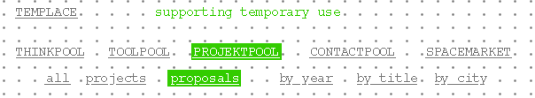
web links
|
Platform for temporary use
a try-out for the future city
time frame: 2003 - 2028 initiators: Project office Northern IJ banks and Stealth group users: large variety of users - from art groups to student housing and sport municipal role: initiator of the project
. . . . . . . . . . . . . . . . . . . . . .
Intro
If, in the near future, you happen to walk along the North Bank of IJ River at the old industrial terrains and docks in the vicinity of the NDSM wharf, you are very likely to encounter the following situation: inside the 20 000m2 hall, a group of around 200 artists and craftsmen called Kinetic North is building a 3-d structure for their working spaces and public performances inspired by Constants New Babylon. On a huge slipway, originally for launching large ships, you will find a bike-cinema. At the foot of the slipway, a metal architectural sculpture, Dazzle-Ville, reminiscent of old-fashioned dazzle painted military crafts, is open as an exhibition space. Some meters further, you can enter a black and stealthy Russian submarine as a museum. Its first neighbour is a 4-storey high student housing building on poles, made out of stacked sea containers. In front of it is a city ballooning outpost located; nearby again, on the tip of the dock, small beach with an open-air bar.
All that, together with a car wash, car mechanics, a Carpet land, some IT companies, a TV studio, design offices, one ferry terminal, a stylish get-away-from-urban-jungle type of restaurant and one municipal urban planning department occupying and empty floor above it
This image is a likely section of time in a 25 years long redevelopment trajectory on the North Banks of IJ. Attracted by available space, affordable price, river, industrial scenery, pioneering drive or by the success of the Kinetic North project for instance, most of the mentioned initiators - protagonists and programs are actually already there - or far underway. (a-analysis)
The desired projection, defined by the current Master plan, defines the same area as one of primary importance, with metropolitan high-density, mixture of working and living inside a series of 30 storey high towers overlooking the river and with some adequately large through traffic.
Concept
The urban redevelopment of large desolate areas of the former shipyards on the river IJ in Amsterdam North brings an extraordinary possibility: the void in usage during time, stretching sometimes as long as 25 years, can be spanned by introducing a large number of transient programs - a temporary city.
The Platform for temporary use is a proposal that spans between these 2 seemingly opposing concepts of urbanity one that is informal, open ended and the other that is top-down and treats a plan as an end goal.
Temporary programs can weave into the structure of the permanent development (currently defined by the Master plan) and disturb it, strengthen it. Temporary use can bridge gaps in use in the development trajectory and respond flexibly to the uncertainties and changing dynamics of each specific area/site. Temporary uses can test the urban ground and catalyse its change, as in a try-out city.
Planning framework
How to bring the unstable category of temporary uses closer to the stability of planning? How to create a strategic and operative framework for temporary use on a large scale?
Planning with temporary uses is very different from regular one. The major distinction is that it has to be sensitive to very diverse and specific initiatives, generally coming bottom up. At present, this energy is dissipating among the various project teams, which are assigned to develop the area. Also, a plan for temporary use has to be sensitive to the local dynamics of development at specific sites.
The Platform for temporary use gives base to such a coordinated approach. It helps to create a larger overview of developments with richer spatial potentials and potentials for programming and to formulate a strong strategy that will gradually build up urban character at the Northern Banks. An executive body, an Agency for temporary use would be formed, in order to provide an organizational, legal and economic infrastructure for temporary uses.
Initial guidelines of the spatial framework for temporary city:
_ there will be no classical zoning; instead criteria for attraction/repulsion between programs are established.
_ the plan will be only partly 'fixed' like a 'cheese with holes'. Pilot projects are strategically chosen for the 'fixed' areas, while the 'open-ended' areas would be free for initiatives to land.
_the basic limitations of the plan will be determined by the inventory of time-space gaps in use. This is a planning tool designed to moderate the puzzle of already numerous initiatives and available spaces, over time. As a consequence, this tool would also allow for the physical mobility of program among several sites, which would increase the duration of temporary programs as well as their feasibility.
In a newly developed area, public space is usually lagging far behind; in a temporary city, public programs are the first to be formed. Successful activities or programs can, with good design and planning, sediment as an urban layer.
The Platform for temporary use thus develops a set of sensitive mechanisms to tap into the real-time needs of the city. By allowing them to develop on the North Banks of IJ, it is effectively turning traditionally inferior position of Amsterdam North, into an advantage.
|
|